
I rolled out of Burley a bit later than intended due to a couple of work-related issues. Carrying my MacBook on my bike has made this trip possible, but it also makes work more accessible, though (as my team will no doubt attest) I haven’t exactly been spending hours each day reviewing code or resolving tickets. Once out of Burley, though, things seemed to happen fast. I cruised up to a nearby farming town, crossed the Snake river on a very old bridge, and then flew straight across land for nearly 25 miles, first through farmland and then into the desert.
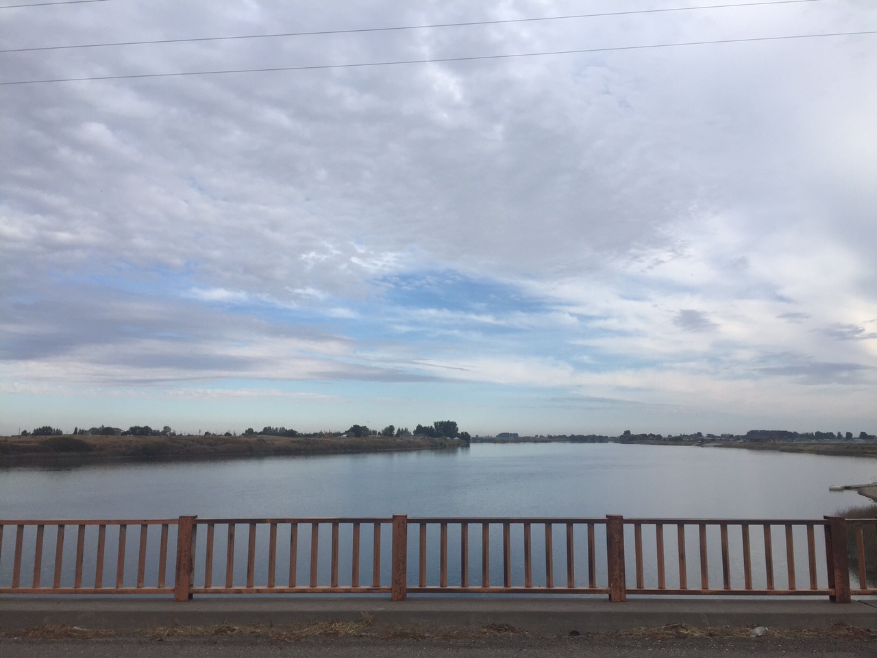
I found myself on a ghost highway — a road that had been US30 in the days before the interstate came, but had since fallen into disuse and disrepair. It was a stunningly straight road, stretching out like a rail, daring anyone to find a kink in its course. The land itself was desolate, rolling gently away from me to a very distant line of hills grew up from the horizon. The only other people I saw for two hours were some hunters who’d pulled their white pickup about a quarter mile down a dirt side road toward the Snake. They were intermittently shooting at something — I could hear the snap snap snap of their small-calibre rifles. I quickened my pace, heart beating.
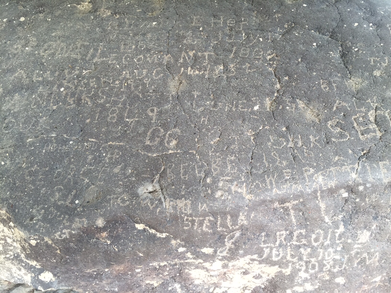
At around mile fifty, I passed Register Rock, a massive boulder in a sheltered hollow of land. The area around the rock was used in the old days as a camp for those on the Oregon and California trails. From the earliest times of the trail, it had been a practice to carve one’s name or initials in the rock, along with the date of passage … “1849 GC” “T Hepner July 19 1889” There were dozens or hundreds of inscriptions by those now long dead who came past this spot mostly on the way to Portland and the Willamette country. Others would follow California route, a branch that split south a scant 15 miles back (for me) or ahead (for them) of the rock, back where the ghost road re-joined the route of the interstate. This would have been the last campsite many on the trail would have had together before diverging — one imagines many sad partings.
I spent last night in Pocatello (a cool, high desert town with a slight methy tinge, but with a University and an excellent brewery) in the shadow of the Bannock range — a scrubby bunch of mountains that draws a 60 mile line down to the norther part of Utah from here. I’ll be in these mountains today, heading for the town of Lava Hot Springs, which I hope is as awesome a place as the name would lead one to believe. I’m going to rest there for a day — maybe even in a hot spring, before continuing south into Utah. See y’all in a couple days.
I am enjoying your writing immensely.
I love Lava Hot Springs and I hope you do too! The hot pools are excellent.
What a cool place — the pools are amazing. So are the hippies 🙂
That rock is so cool. Thanks for the history. Did you add your name to it? Or maybe “Dempsey #2” LOL
Deuce!
Your video captures the expanse and quiet of that territory, wow! Thanks inviting us along the trail with you.