For those who don’t live in the Pacific Northwest, we just lived through one of the most crap-tastic winters in recent memory … plenty of cold, snow even at lower altitudes, a ton of rain and gloom. When the thermometer broke 80 degrees only a couple of weeks ago, it hadn’t done so in the city of Seattle in over nine months. Boo.
But the recent positive break in the weather has made it possible to think realistically about summer riding, so that’s what I’ve been doing. I have a medium-sized trip planned for late July, with a couple of warm-up cycling experiences set for the couple of months before then. As usual, I hope to blog while I ride … it seems that my ability to actually write words on the internet is itself pedal-powered.
June/Early July Warmup: Cascade Loop
A good warmup for the summer is a three-day loop from Seattle -> Cle Elum (via IronHorse) -> Leavenworth/Icicle Creek -> Monroe. This will be a pretty strenuous warm-up that will take me over three passes in three days. Come to think of it, I’d better get my ass in shape for this pretty soon.
Late July: Minnesota
I’m planning to start in International Falls, MN and ride down the spine of that great state, through the big north woods and through little places like Orr, Grand Rapids and Walker and thence down to the town of Little Falls (the home of our friends Bob and Linda) and then through St. Cloud and into Minneapolis to visit our dear friends Bethany and Stamatis and their new kid. I plan to mostly camp on this trip, which should be notably buggy, but also flatter than the big ride of two summers ago, and the small one of last summer.
WorkBike: France, Scotland, Canada
This summer my job will take me to some interesting places, so I’m making an effort to use pedal transportation in those places as much as possible. My work team is having a mini-conference outside of Glasgow, I have a conference in France, and our company meet-up is once again in Whistler, BC in September. In all of these cases I’m trying to make it to these places without the aid of a car, using only pedal power — and who knows I might have some adventures along the way 🙂
If anyone is in any of these places this summer and wants to ride along, please let me know!
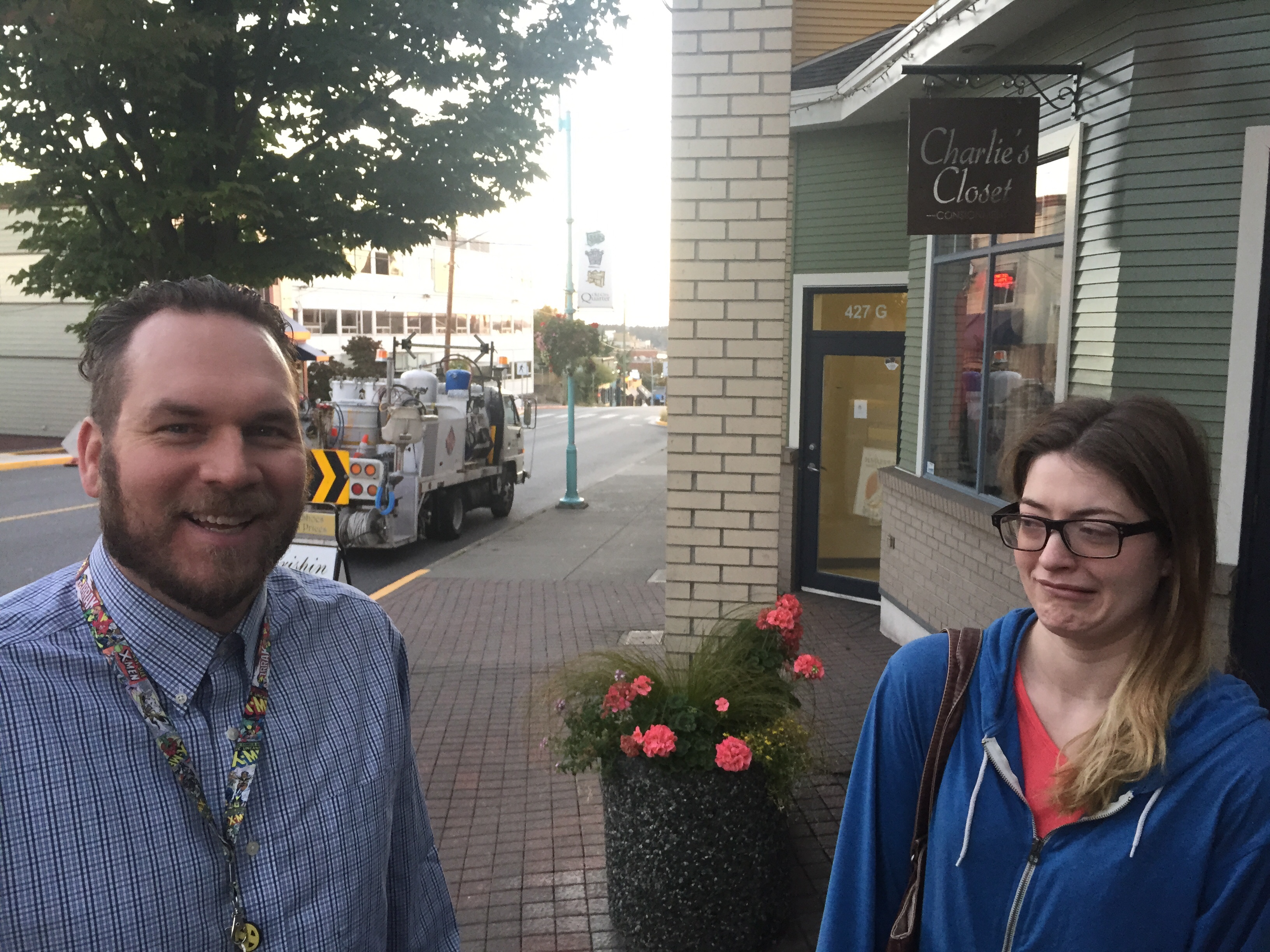
Morning in Nanaimo. My brother (who lives there) called me at some ungodly hour, and at which point I rolled over and was informed by my legs that I had ridden a bunch of miles the day before. My bro Seth works in Nanaimo as an addictions counselor at Edgewood, which means he is a) a saint and b) capable of calming down large dudes who are coming off of various drugs (he’s a big dude himself luckily, so this is all good.) Along with his girlfriend Clarice, we headed out into town to get some coffee and carbs and chat for a while. It was great to see them.
Clarice “laughs” at one of Seth’s jokes.
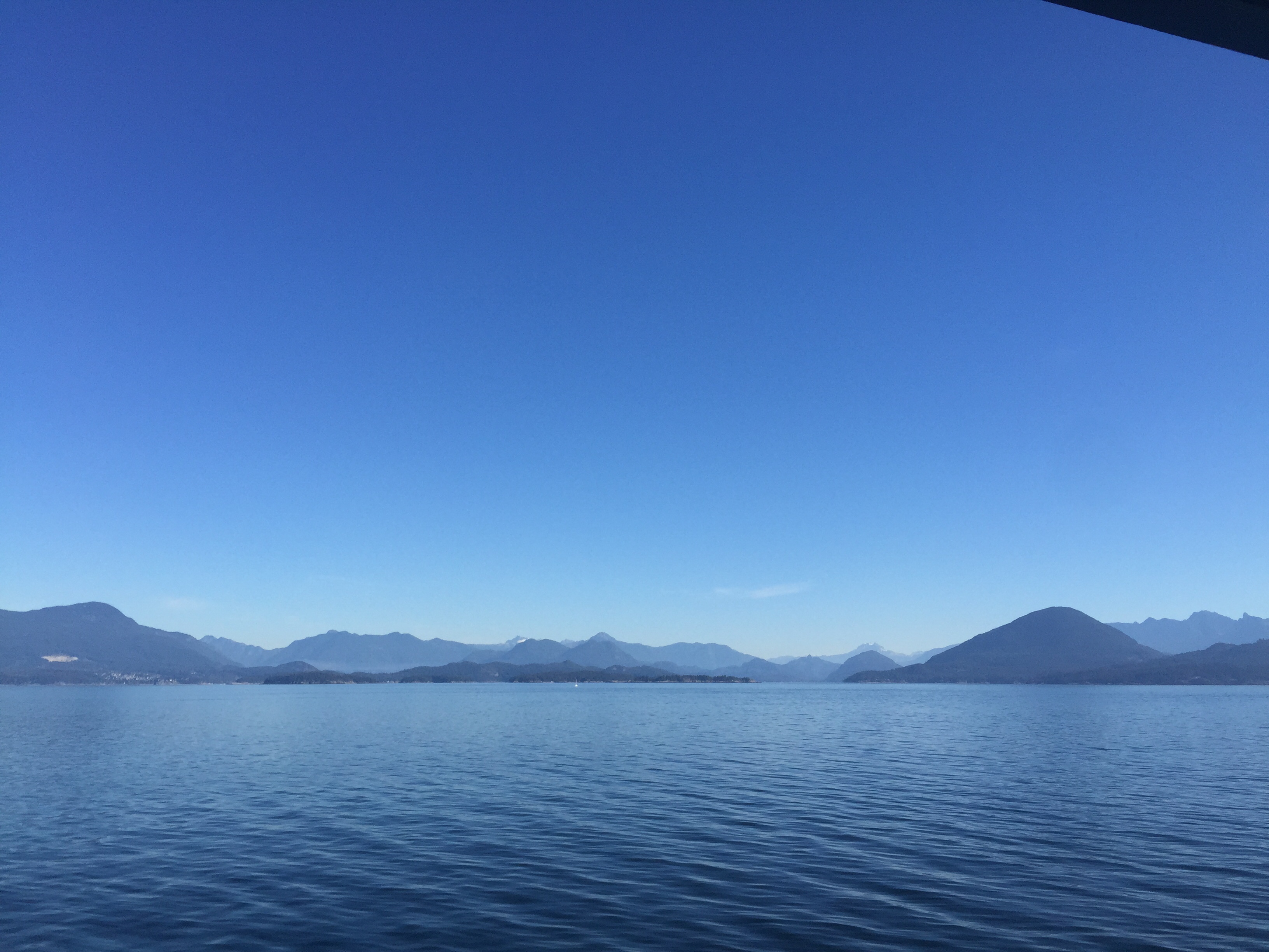
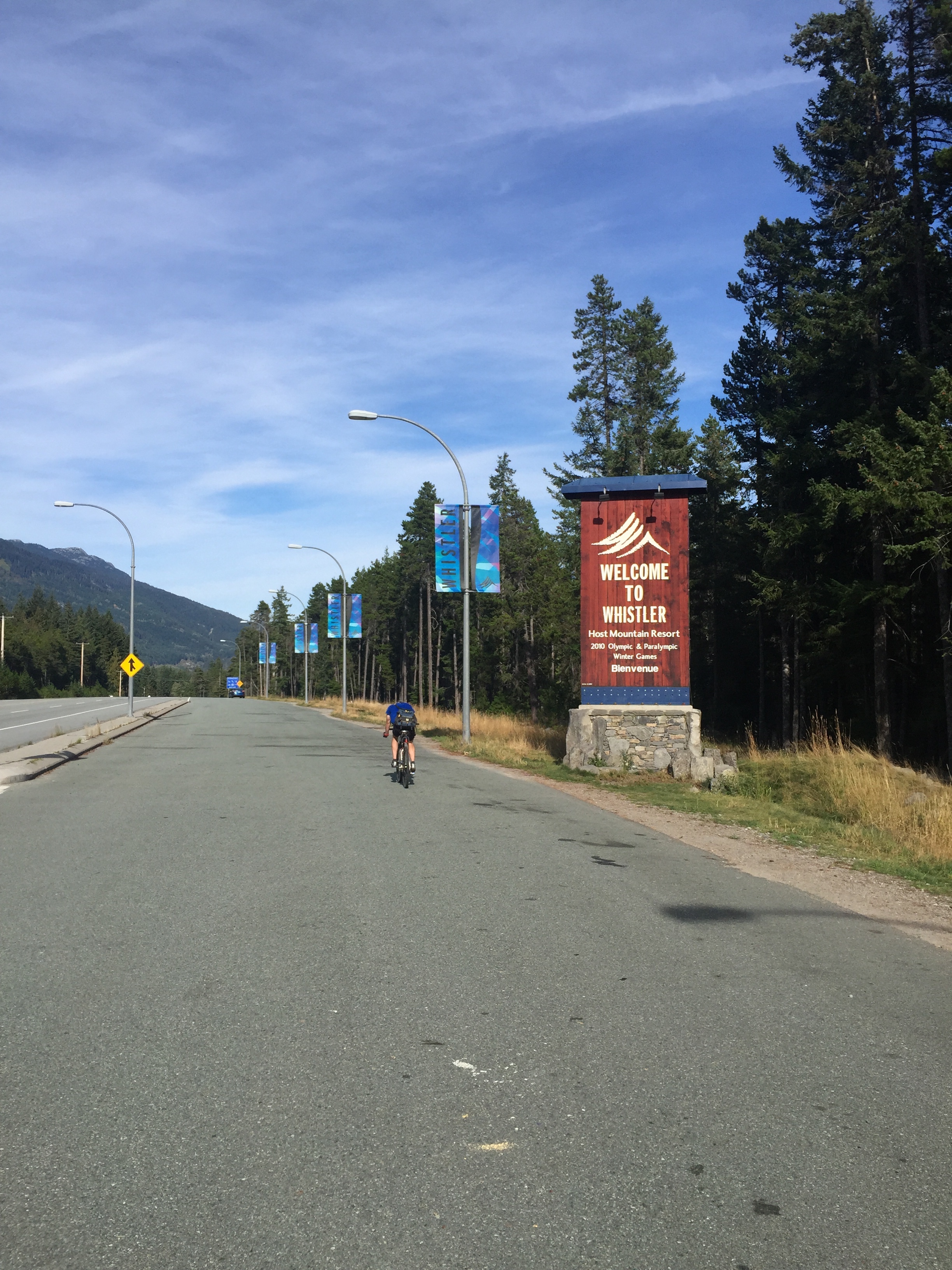
Soon thereafter, I met back up with Josh and Mark to head down to the ferry to Horseshoe Bay (West Vancouver) and the start of the day’s ride. As we neared the mainland, we cruised past the mouth of Howe Sound, a 25-mile long massive Fjord that juts deep into the coast mountains. We’d spend the first half of the riding day weaving our way up the highway along its shore. (More on that in a moment.) From the Straits of Georgia it looked peaceful, an ideal place to ride.
Howe Sound from the ferry. Peaceful
The climb out of the hollow of Horseshoe Bay was a foretaste of the pain to come — it was quite steep, and involved several switchbacks even before we arrived at the main highway. Our left onto BC Highway 99 was our last navigation decision of the day. This highway would take us up the northeast shore of Howe Sound to Squamish, BC and thence up the large hill to Whistler, the site of the Automattic Meetup. Some facts about BC highway 99 — aka the “Sea to Sky”:
it’s the northernmost segment of the longest highway in North America. It begins in Baja California and extends up to near Lillooet BC. It was extended to Whistler, BC only in 1964 — prior to that the road past Horseshoe Bay was rough.
it was drastically improved prior to the 2010 Olympics, since it was the main road connecting the main venues in greater Vancouver and Whistler.
The improvements included road widening and new safety barriers (when I was in high school it was a continuous two lane road on a cliff with few safety barriers — it’s significantly better now.)
Road improvements were opposed by many indigenous groups and others, including many of the Squamish. Famously, a Squamish elder named Harriet Nahanee was said to have lost her life as a result of her incarceration after one of the road blockades prior to construction.
The road used to be rated near the top of many lists of the worlds most dangerous roads. This is probably not so much the case anymore after extensive improvements, but it gives you some idea about the safety of the road — high volumes of fast traffic, areas of minimal shoulder and occasionally (apres-ski) intoxicated drivers have resulted in a sad history of fatalities and injuries.
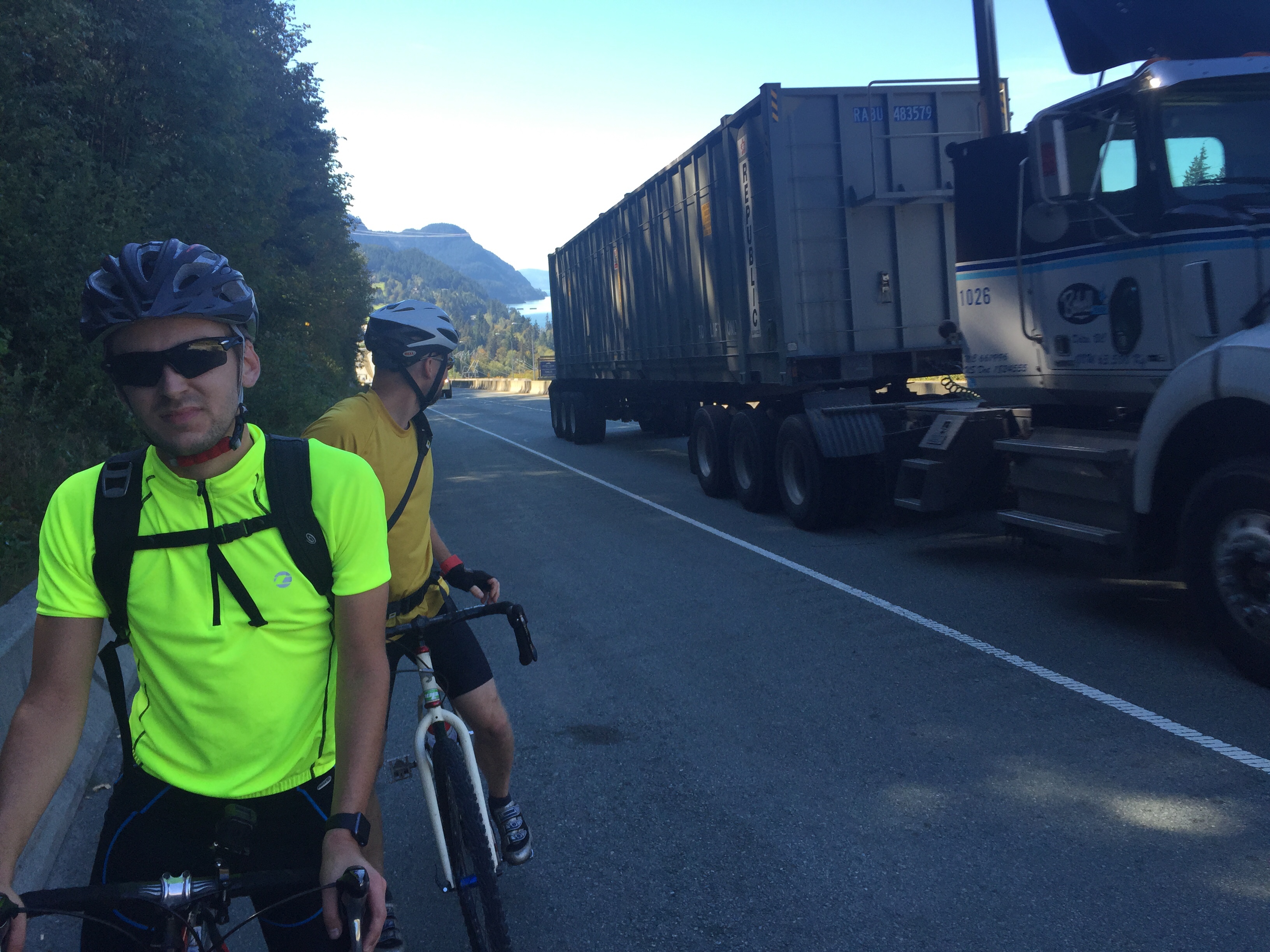
As we set out on this beautiful road with its unbelievable views of Howe Sound and the Coast mountains, it was the road itself and not the scenery that was heavy on my mind. The next five or six hours would prove to be an exercise in concentration: not only was the highway continuously dangerous, but fatigue would become more and more of an issue as the day progressed. There is some uncertainty about the total climb for the day, but it is large. Google states it at between 5-6,000 total feet of climb, but we tracked some 8-9,000 feet. The number is probably somewhere in between those two ranges. As fatigue sets in, judgement and concentration wains. I know from some experience that bad mistakes are more likely late in the day when we are more physically and mentally tired. This day of riding was an example of one that required continuous concentration, and also honesty with ourselves about what we were ready to take on, and when. Safe road touring is all about never getting into a situation that you can’t get out of — whether that be not embarking on a day or part of a day of riding where the weather or wind conditions are uncertain and possibly dangerous, or deciding to end early if safety conditions demand it. I was really happy to be riding with two guys who understood this idea and showed it all day.
uphill with trucks — this part of 99 had good shoulders
After lunch the bulk of the climbing began. Climbing is about psychology. It is going to hurt — that’s a given. But how you manage the pain and discomfort, and your own expectations about how long it will last and how it will feel are the real challenge.
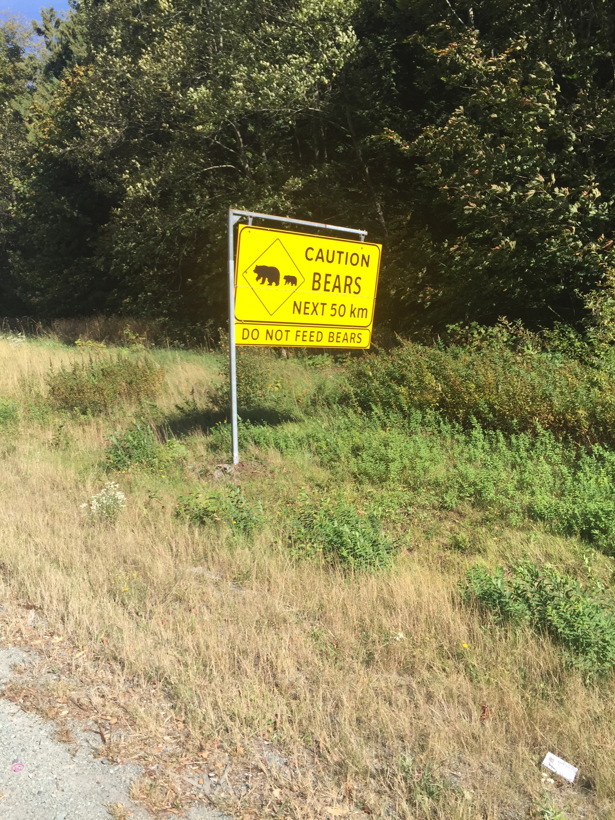
Also, bears:
Though one imagines that these signs are around to discourage people from feeding the local osos. Here’s Mark on the hill, as we approached the Whistler area:
Mark, working it.
We arrived in Whistler tired and messy. We ate a whole bunch of food. Then we ate some more. Then we slept.
Days like this remind me why I love cycling. Sure there were cars, and there were some dangerous conditions. But enjoying an activity like autonomous road touring is all about learning how to manage risk and pain, and manage your own emotions and feelings about risk and pain. It’s also about being with other people, and being alone with other people. Even if cycling in a group, the challenge of climbing a mountain is your own physical one, even as the group travels together and looks out for eachother.
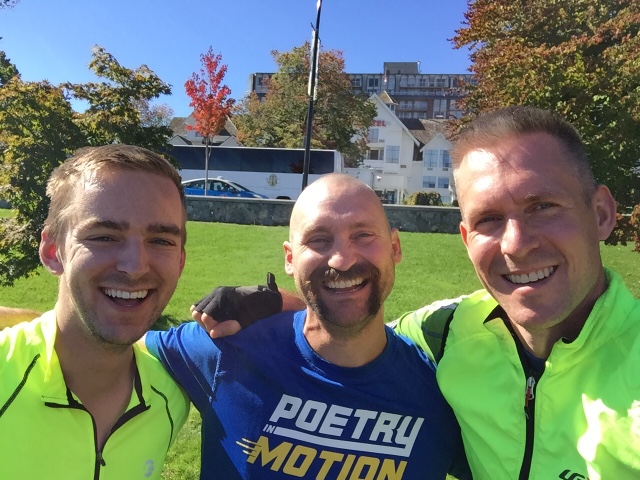
Many thanks to Josh and Mark for making this a cool two-day journey, both through the countryside and through parts of my own self that are only accessible when I put myself and a bunch of stuff on a bike and set out into the world.
Yesterday I spent a great day with friends cycling from Victoria up to Nanaimo along the southeast coast of Vancouver Island.
I met up with my co-workers Josh and Mark outside the Victoria Clipper terminal in the central harbor of Victoria. BC. They looked eager to start out so we began by cycling through downtown, passing the British Columbia legislature on our right. BC is possessed of one of the more “colorful” political landscapes in Canada … over a certain period of time something like four of the five recent Premiers of the province ended up under investigation and indictment for various reasons. The second leader of the Province was a man named Amor de Cosmos, who apparently entertained a number of opinions that accorded rather well with his name.
As we prepared to roll over the Johnson Street bridge, Mark’s chain suddenly decided to fall off. This was actually fortuitous since at any other point in the journey this would have presented us with a significant delay, but as it happens we were exactly two blocks from Mountain Equipemtn Co-op which has a massive bike department, and Mark was able to get himself back on the road in about fifteen minutes.
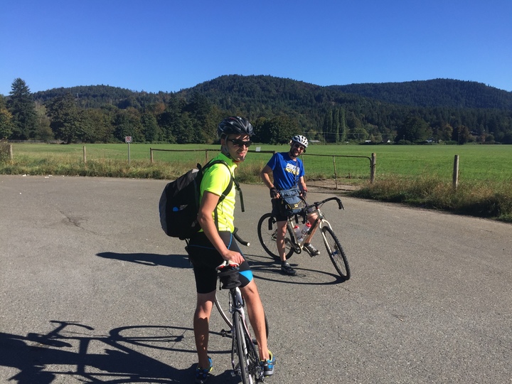
Repairs done, Victoria flew by quickly, a quick succession of bike paths and city streets, and before long we were in the countryside, creeping over hills and flying through beautiful valleys and past farms. Workers were bringing in the hay in the warm sun. One particularly beautiful road, a single lane really, took us through the lands of the Cowichan peoples and through the beautiful valley of the eponymous river, which languished still and brown as we crossed a series of plank bridges through one of the small reservations. Along the way we dropped down into a series of seaside towns — Chemainus with its murals, Cowichan Bay with its chintz.
Mark and Josh in the Cowichan Valley
For the last two hours before Nanaimo, we were forced on to the Trans Canada Highway, which was far less pleasant. Truck exhaust, grime and usually-but-not-always-large road shoulders were with us almost all the way into the city, which we all dearly wished would invest in some cycling infrastructure. Nanaimo is a resource town with a slightly depressed feeling. It’s all about sawmills and logging, but is also a magnet for the regional economy and a bit of an inheritor of other people’s problems. There are (perhaps apocryphal?) stories of the police in Vancouver buying particularly troubled people a one-way ferry ticket to Nanaimo — a form of extrajudicial exile. Nanaimo is also the home to the most famous drug and alcohol treatment facility in Canada, which brings many addicts to town, recovered or not. Many other poor people, largely first nations, end up in town for work or family or to live in a bigger place, or sometimes one imagines because they have nowhere else to go.
I thought of all of this as we rolled into town, checkin in to a cheap hotel and longing for a burrito and a rest. Our bodies (mostly their posterior portions) were complaining about being in bike seats all day, and we fell asleep with ferocity.
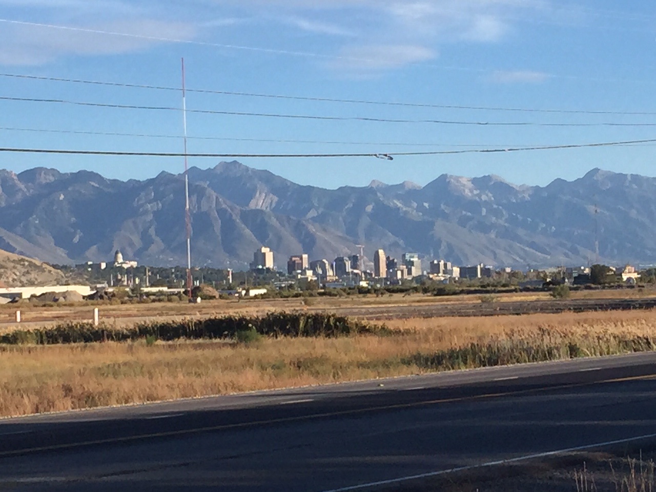
Holy crows! I’ve made it to Salt Lake City. Here’s the view I saw when I rounded the corner from the area west of Bountiful as I began to follow the course of the Jordan river into the city.
Salt Lake City, Wasatch Mountains
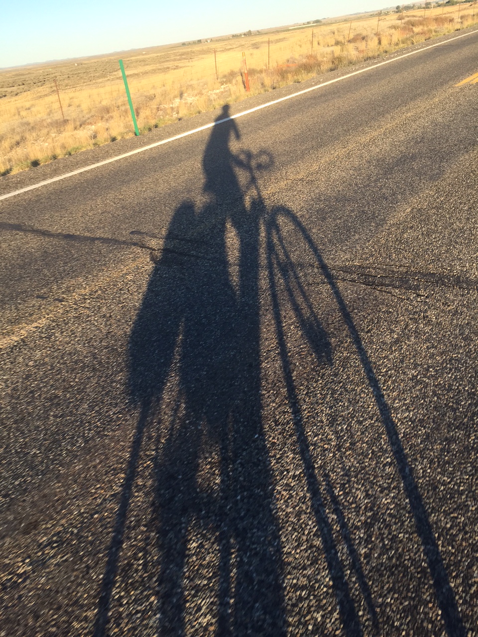
The sun was starting to get low (you can see the long shadows on the road) and the swampy and scrubby land all around became golden in that light. It had been a hard day, and I felt a sudden sense of relief and catharsis to be able to finally see the end of my journey (almost) rising up ahead. I let out a big whoooooop, which I’m pretty sure that no one could hear, but I’m fine with the idea that someone did. At this point everyone thinks I’m insane anyway.
The day had been hard. It wasn’t the most physically demanding of the trip (that would have to be the ride from Prairie City to Vale in Oregon) but it wasn’t too far off in terms of how I felt at the end. The milage was slightly on the long side, but not too bad — a respectable 85 miles. And there was one mountain pass. I had to ascend out of Logan, Utah and over the north end of the Wasatch back down into the Salt Lake basin. This pass was made worse by the altitude since at well over 6,000 feet it was my highest climb yet, even though the total gain involved was under 2,000 feet. Despite having been above 4500 feet for a while now, It’s pretty hard to climb up there, and the sun is extremely harsh. I’m trying to be very careful about sun exposure right now — I’d managed to badly sunburn my lower lip earlier in the trip and it has remained an irritated mess (and caused other mouth problems.) I’ve amassed a collection of several ointments to deal with the issue, but none seem to be working that well.
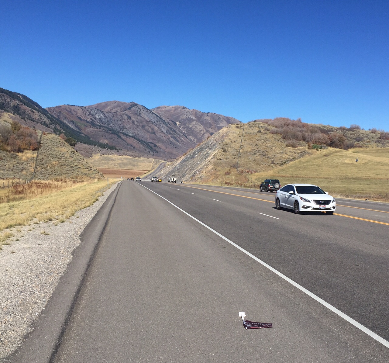
Looking back on part of the morning climb. The object in the foreground was a Seattle Seahawks fan flag. Some kind of omen? I thought about picking it up, but I was kind of tired.
There were other small annoyances today which added to the slog. For the first 40 miles, traffic was a real problem. Though US 89 over the mountains had nice wide interstate-style shoulders, those immediately disappeared in Box Elder County south of Brigham City. There were a few sketchy parts with no shoulder before I got on a suitable road, and I’m glad I was clear-headed and experienced enough to handle them. For the last 50 miles or so, the wind was a real bummer. It blew in my face at about 10-15 miles/hour, cutting my speed by about 2-3 mph and adding a lot of effort to every mile. In the few places where the road was sheltered from sun and wind giant clouds of gnats lurked. These stuck to my clothes, arms and glasses in a thickening matte which I soon gave up trying to scrape off.
On the other hand, there were good moments too. For the last 30 miles into the city I was away from traffic entirely on a great deserted bike trail. Thanks Salt Lake City! And I saw the most beautiful formation of migrating geese descend in a glorious chevron over the Mantua Reservoir as I sped down the backside of the mountain pass I’d just climbed. But by the time I rolled into SLC I was pretty burned out, and ready for a break and a sushi burrito with my friend Rachel. Today is all about sleeping and catching up on a bit of work. Tomorrow I’ll load up the bike one final time for the 35 mile ride up the hill to Park City, where I’ll spend a week with my co-workers. Maybe I’ll post some kind of summary at some point, but for now I’m going to get busy resting.
I was back in the saddle today after a day off in the enclave of Lava Hot Springs, Idaho (population ~400.) I can’t recommend this place and its perfectly crystalline hot pools enough. Go there! If you do, you’ll also understand where all of the hippies in south eastern Idaho went — those that didn’t leave entirely.
The ride out of town and back down into the broad valley of the Pontneuf river was a joy — I was rolling swiftly and made great time in the morning under a non-threatening cloudy sky that more than anything kept the harsh sun away. It was an amusement to watch the shifting patterns of clouds above me; now dark, now lighter, now entirely blue. What part of the shift was due to the clouds, and what was due to me, inching my way along at a respectable 14.5 mph? Aside from a few temporary headwinds, I made great time, and was soon pointed directly south at Preston, Idaho, a scrubby town less than ten miles from the Utah line (and, incidentally, the setting for the movie Napoleon Dynamite.) So I knew where I was going … but what I wasn’t prepared for the drama and tragedy the next sixty miles of this valley would reveal.
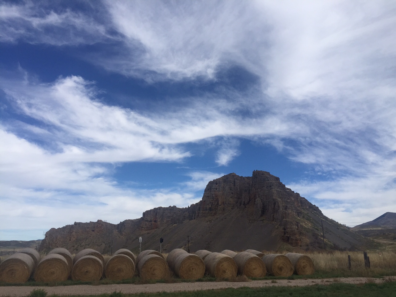
Red Rock Pass
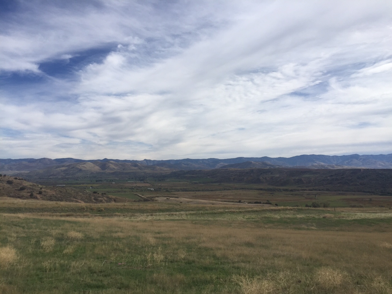
From the north, you can’t see Red Rock until your almost on top of it. It’s a pockmarked, gnarly looking butte to the right of US91, a mere point of minor geological interest, I thought, until I reached a small installation with some geological information from the always-helpful Idaho Historical Society. What I learned from their rustic sign was that this rock formation and the gap in which it sits was the outlet to a vast inland lake — a sea almost — which extended from this point in the north down the broad valley in front of me through the Salt Lake basin and all the way down far far into Nevada. In fact, the current Great Salt Lake (shrinking still) is but a remnant of this truly massive body of water which dominated the entire region until about 8,000 years ago when it began to recede and disappear due to a drying of the climate. Right under Red Rock flowed a rushing river with the volume of the Amazon which helped to drain the lake. Eventually it drained it totally — and the lakebed was now a desert, or a marsh, or in places a pasture. But scanning to the south, I could almost see its ancient contours marked on the hills and mountains all around — a broad, flat-bottomed valley which was the lake’s old bottom. And the high mountains, re-encroaching on my journey for the first time in a week — these would have been made islands or isthmuses by the expansive waters.
In deep time, no one owns the earth. It sweeps away the living and the dead. Seas rise and fall, climates change, entire ecosystems collapse or are birthed. This is a source of fascination for me, and of comfort. Because it seems so often that in the short term we do our best to dominate the land, to steal it and its products and to water our crops with the blood of other people. And so it was in this valley.
The first to inhabit the old lake-bottom were the western Shoshone people. This was their traditional hunting ground, used for thousands of years in as part of their annual hunting and gathering cycle. The next were the Mormons under Brigham Young, who by that time had established Salt Lake City and whose settlers had pushed up the Cache valley into this area. Then came other American pioneers — those who followed the Oregon and California trails and either homesteaded or exploited this land on their way through, and also gold miners who used the valley as a road and source of food. The land was getting crowded. The Mormons and other settlers began taking so much game (buffalo, elk, animals for fur) and land for cultivation that the Shoshone became impoverished and starved and were reduced to begging and sometimes stealing food from the newcomers. There were conflicts — real and invented, between all parties. The Mormons fought the US Government (there was a brief war even.) The Mormons then tricked and fought the Shoshone. The Shoshone, possessed of a keen sense of blood revenge, killed in the measure that they themselves were killed. The Mormons encouraged the Shoshone to steal from US wagon trains, and when they did the US responded without mercy. In the midst of the civil war Lincoln dispatched soldiers from California to crush the Shoshone’s non-existent “rebellion.” In January 1863, their main camp on the shores of the Bear River was attacked and harshly destroyed. Over 400 men, women and children were butchered and raped in the most ruthless fashion and their dwellings destroyed.
looking down into the Bear River valley, site of the massacre
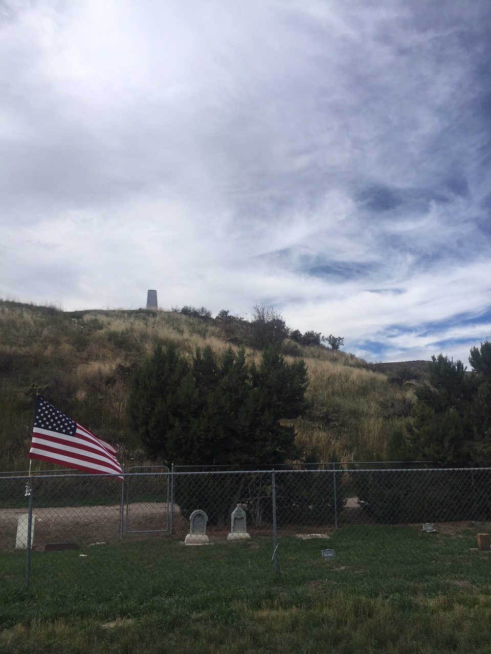
As I descended towards the bottom of the valley of the Bear, there were memorials from all sides. Native Americans commemorated the massacre by tying ribbons, yarn and other objects to certain trees. These flapped quietly and colorfully in the light breeze. Typically, we Americans erected a threatening-looking obelisk complete with shameful inscription: Erected 1932: the battle of Bear River was fought in this vicinity January 29 1863. Col. RE Connor, leading the 300 California Volunteers from Camp Douglas, Utah against Bannock and Shoshone Indians guilty of hostile attacks on emigrants and settlers engaged about 400 indians of whom 250 or 300 were killed or incapacitated including about 80 combatant women and children. 14 soldiers were killed, 4 officers and 48 wounded of whom 1 officer and 7 men died later. 72 were severely frozen. Chiefs Bear Hunter, Saowitch and Lehi were reportedly killed. 175 horses and much stolen property were recovered. 70 lodges were burned.
70 lodges burned. 80 “combatant” women and children. 250 or 300 killed (it was actually over 400.) In a way, it was a strange relief to see it all spelled out and counted like that, our government’s old and enduring cruelty to the original inhabitants of the land. Knowing exactly what happened, even if it’s presented in a twisted and near-celebratory context like this one, is at least in some way better than forgetting. I pedaled on, unable to think of anything else. I hope that monument stands for a long time and reminds us of what we as a country did at Bear River, and at so many other places across the west — of the cruelty and blood on which our mythical west is built, and on which we live and walk every day.
An old pioneer cemetery. Many of the headstones were for babies.
As the old lake-bed widened, I entered the state of Utah — center of American Mormonism. For some days, there’d been an LDS church in just about every little town I’d rolled through (Mormons are populous in southern Idaho too.) But now, the church was absolutely everywhere. Every single subdivision in Logan clustered around the spire of a Mormon church. Every single farming town had one too. I could see the grand temple of Logan from over 7 miles away, its twin spires pointing at the sky as if to say “Up there! Look away from this old lake bottom where so much blood has been spilled. Look at the sky and wonder about the clouds and ride your bicycle and don’t worry about it.”
It didn’t work. At the end of 81 miles I was still troubled by what I’d seen and learned. So I went to see a movie — the Martian, in which Matt Damon plays an astronaut trapped alone on Mars … a planet with no massacres, wars or nations. At least not yet.
I rolled out of Burley a bit later than intended due to a couple of work-related issues. Carrying my MacBook on my bike has made this trip possible, but it also makes work more accessible, though (as my team will no doubt attest) I haven’t exactly been spending hours each day reviewing code or resolving tickets. Once out of Burley, though, things seemed to happen fast. I cruised up to a nearby farming town, crossed the Snake river on a very old bridge, and then flew straight across land for nearly 25 miles, first through farmland and then into the desert.
Snake river crossing #2. Looks about the same as two hundred miles ago.
I found myself on a ghost highway — a road that had been US30 in the days before the interstate came, but had since fallen into disuse and disrepair. It was a stunningly straight road, stretching out like a rail, daring anyone to find a kink in its course. The land itself was desolate, rolling gently away from me to a very distant line of hills grew up from the horizon. The only other people I saw for two hours were some hunters who’d pulled their white pickup about a quarter mile down a dirt side road toward the Snake. They were intermittently shooting at something — I could hear the snap snap snap of their small-calibre rifles. I quickened my pace, heart beating.
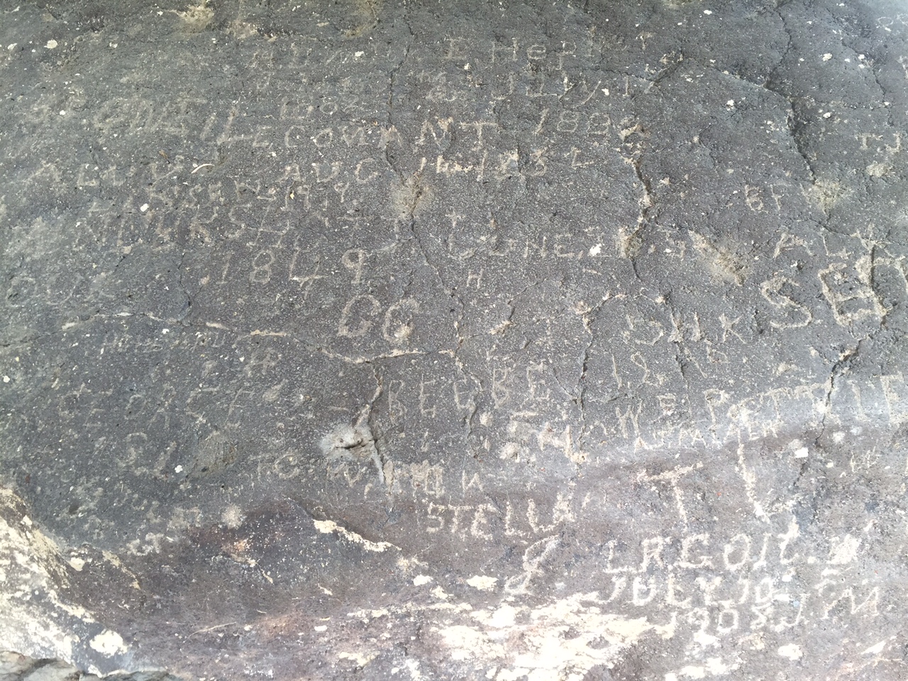
At around mile fifty, I passed Register Rock, a massive boulder in a sheltered hollow of land. The area around the rock was used in the old days as a camp for those on the Oregon and California trails. From the earliest times of the trail, it had been a practice to carve one’s name or initials in the rock, along with the date of passage … “1849 GC” “T Hepner July 19 1889” There were dozens or hundreds of inscriptions by those now long dead who came past this spot mostly on the way to Portland and the Willamette country. Others would follow California route, a branch that split south a scant 15 miles back (for me) or ahead (for them) of the rock, back where the ghost road re-joined the route of the interstate. This would have been the last campsite many on the trail would have had together before diverging — one imagines many sad partings.
19th century graffiti
I spent last night in Pocatello (a cool, high desert town with a slight methy tinge, but with a University and an excellent brewery) in the shadow of the Bannock range — a scrubby bunch of mountains that draws a 60 mile line down to the norther part of Utah from here. I’ll be in these mountains today, heading for the town of Lava Hot Springs, which I hope is as awesome a place as the name would lead one to believe. I’m going to rest there for a day — maybe even in a hot spring, before continuing south into Utah. See y’all in a couple days.
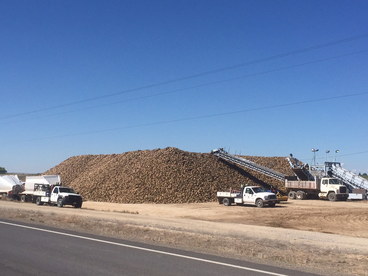
Today was a day of roughly following the Snake river, and I84 (but neither too closely) as they both plunged headlong east. In about 50 more miles the river, but not the freeway, bends north toward its origin in the Tetons and Yellowstone National Park, but for now it heads directly east, through a gap between the low mountains of central Idaho to my north and the growing hills to my south. Today was also a day of vast fields of potatoes and sugar beets, of corn and hay and of farmers in huge vehicles working to get the crops in. The river feeds the land around here through a network of irrigation channels, many of which I crossed on little bridges on the secondary roads I took from Bliss down to Jerome, Idaho, north of Twin Falls. I decided to skirt this small city rather than enter it, and stayed deep in the farmland nearly all day, picking my way through the little agricultural towns that used to support the farming communities around them.
a mountain of sugar beets. I stopped for a bit to watch them being loaded.
Many of these little towns are shells of their former selves — depressed little places with boarded-up buildings and only a few functional businesses and churches and perhaps a school or two. Farm families are more mobile than they used to be, and can drive the extra 15 minutes on the freeway to get to a WalMart or a chain supermarket rather than rely on the businesses that their forbearers likely patronized every day. Of course this change isn’t unique to this part of Idaho, but today I felt like I noticed it with particular sharpness as the haul of crops was brought in from the beet and potato fields all around me. At the same time, the only food on sale in any store was processed, packaged, or (maybe) fried — and all shipped in from far away. There was poverty too — the pretty obvious kind. Federal programs providing nutrition to pregnant women were advertised in every store window while Fox news blared loudly in the background. At one point a woman in her seventies with strange growths on both of her arms approached me as I was resting and asked me to help her son move a large couch. We moved it, he and I, into a falling-down house. His two daughters watched.
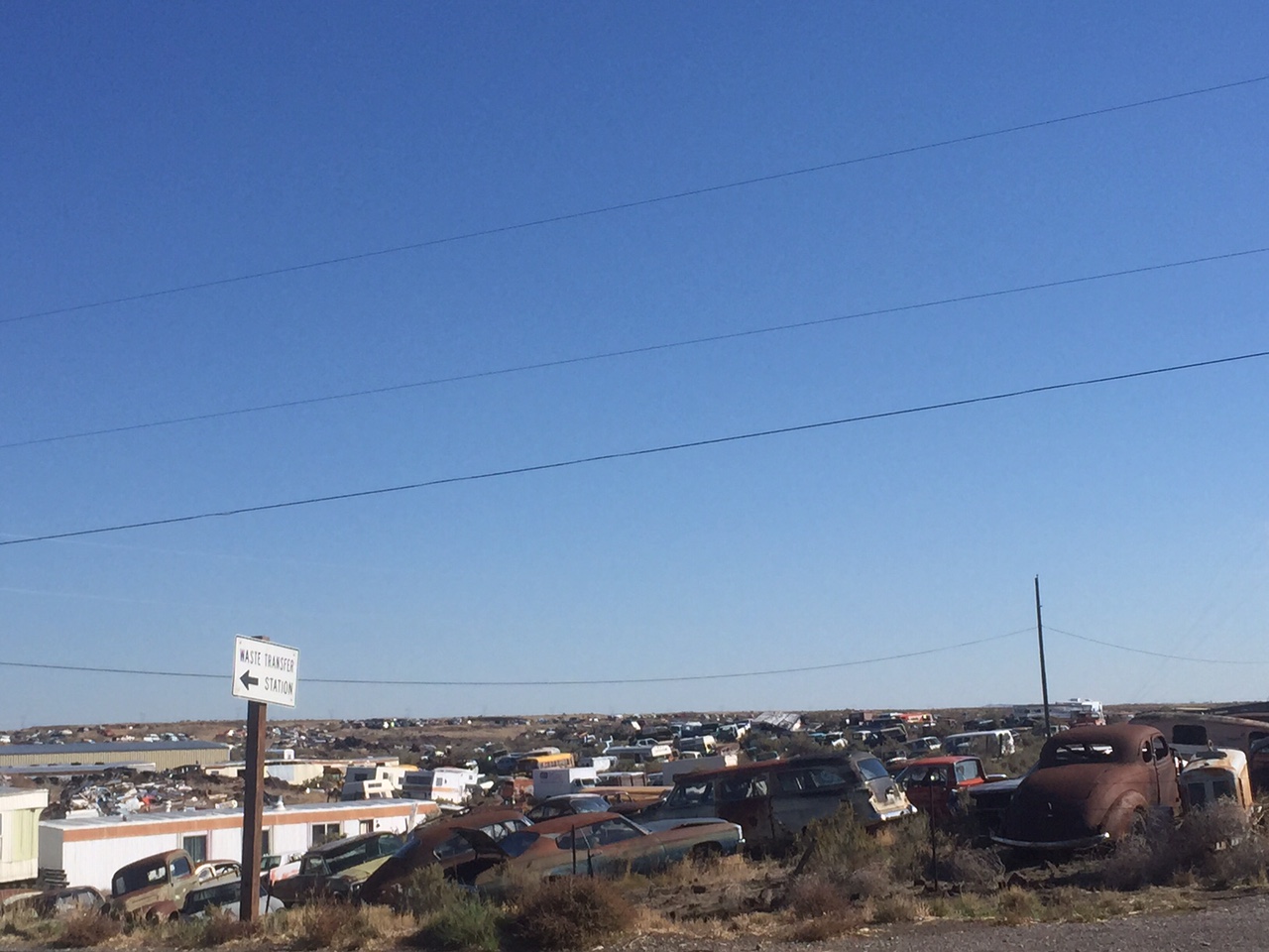
dead cars to the horizon
There’s something about rural America that blurs the lines of reality and fantasy and makes me doubt for just a second that there isn’t something … untoward … going on beneath the surface. At one point I turned a corner and was confronted by the biggest junkyard I’d ever seen — if a junkyard it even was. Dead cars, trucks, some of them very very old, stretched nearly to the limits of my sight. It was as if an entire section of someone’s farm had been surrendered to them and become a massive automotive graveyard. Maybe this air of unreality has to do with the fact that so many people here (and elsewhere in red America) believe, in quite a matter-of-fact way, certain things that are for me difficult to even imagine. “What is happening in our world lately?” demanded a placard at one gas station picturing a blood-red sunset with threatening clouds. “Join us Wednesday nights at Valley Christian Center, 35 Main Street Hazelton at 6pm, to find out. We will be taking a walk through the book of revelation with the series Agents of the Apocalypse”
If the world is going to end, then what isn’t possible?
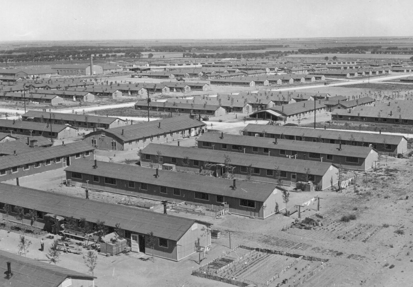
I’ve always thought that many Americans are possessed of a poor sense of when to pay attention to the past and when to look to the future. We quote the founding fathers when it suits us, but forget them as soon as it doesn’t. We commit obscene acts of genocide and crimes on a massive scale, and then forget that they ever happened. Half of us (or something) believe a supernatural apocalypse is coming, but we refuse to foresee the natural one we’re creating with our cars, coal plants and airplanes. I arrived at the turn-off for Hunt, Idaho at about 2pm under a hot sun. Hunt was the location of a concentration camp during the second world war which imprisoned over 9,000 entirely innocent American citizens of Japanese descent. The US government forced the sale of their property and businesses and then removed these Americans to places like this in the high desert for the duration of the conflict.
At the turnoff, a sign read: Excluded from their west coast homes by military authorities, over 9,000 Japanese Americans occupied Hunt Relocation camp 4 miles north of here between 1942 and 1945. Until they could resettle to other places, they lived in wartime tarpaper barracks in a dusty desert where they helped meet a local farm labor crisis, planting and harvesting crops. Finally, a 1945 Supreme Court decision held that United States citizens could no longer be held that way and their camp became Idaho’s largest ghost town. This sign (provided by the Idaho Historical Society) and its softball gloss of history are so offensively terrible that I won’t comment on them here, but the whole scene seemed only to add to the air of unreality — of denial and fantasy — that permeated this countryside.
Maybe I’ve been thinking dark and deep thoughts today because my rear end is really killing me — just a theory. Seven hours in the saddle is a lot, and I’ll be glad for another day off on Thursday, and a short day Wednesday. But as I drew close to Burley, my home for the night, I started pondering tomorrow and its challenges. It’ll be another longish one — today was 80 miles, tomorrow will be a few more even. And the route is a bit uncertain — all roads except I84 itself more or less fail about 50 miles to the east of here as the Snake enters a bit of a canyon, and it looks like I’ll be back on the freeway shoulder for about 6 miles tomorrow afternoon. But the day will end in Pocatello which is a pleasant-seeming college town. The day after tomorrow I will turn south and make for Utah and the end of the this voyage … assuming the apocalypse doesn’t happen first.
I’m in Bliss … Idaho. Population 318. Today had it’s blissful moments, sure, but it was also a pain in the ass. For every wide open desert vista or unusual encounter, there was a slowly leaking tube (again!) or a spell on the interstate shoulder (one of only two I’ll need to endure during this trip.) So it was a mixed bag. But I’m here at the end of 96 miles feel and I feel strong and good.
I hadn’t originally planned to stop here in Bliss, but it was my stretch goal today, and I’m glad it worked out. The original plan was to overnight at Glenns Ferry about 20 miles back on the Snake River. But the fact that I’ve pushed on here makes a big difference in the coming days — it means that I can spend Tuesday night in Pocatello, Idaho (a town of some size and coolness) rather than American Falls (a town of neither.) It also turns Wednesday into a very short, pleasant day of only about 38 miles, with a hot spring at the end. After that, I’ll be taking Thursday off the road (some work, more hotspringing) and will hit Utah on Friday.
Mark. He’d just slept in the sagebrush behind the rest stop.
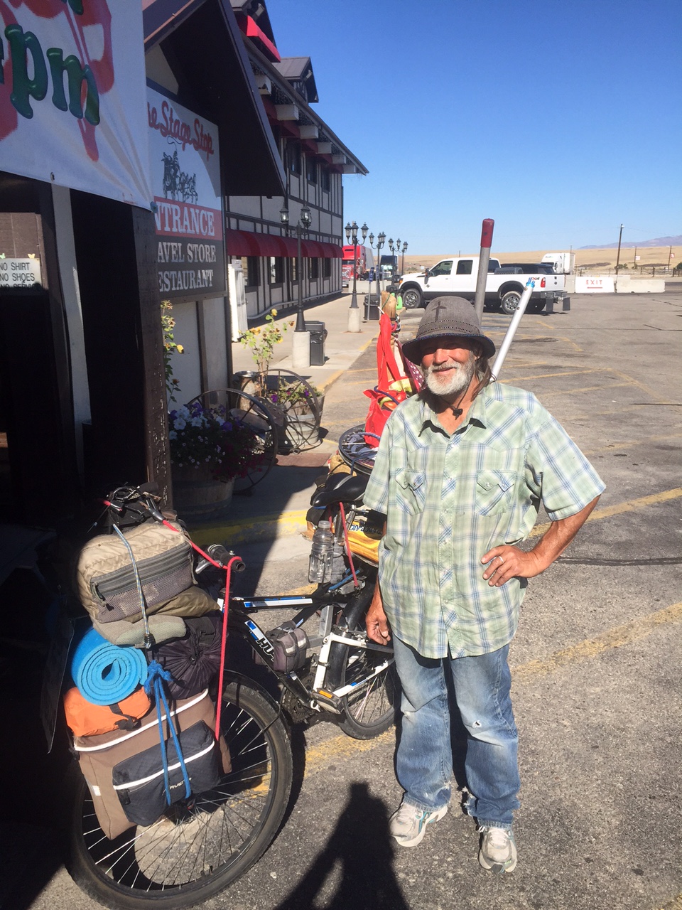
But I’m getting ahead of myself. Today I rolled out of Boise to the southeast, staying off I84 for as long as possible. After a certain point, however, choices narrowed to a rough dirt track and the wide shoulder of the interstate. I endured the former for about 11 miles, and then it was back off at the “Boise Stage Stop” — a former hotel turned rest area and diner. The place was strange — there was some kind of dingy 24 hour mini movie theater, presumably for long-haul truckers who needed to stay off the road for a mandated number of hours. Sitting out front in the shade, I encountered my fist fellow-cyclist of this trip. Mark pushed his piled-high bicycle into the vestibule. According to him it was a cheap WallMart mountain bike that he’d modified. It was stuffed front and back with stuff he’d collected from his travels all over the west. Some of the stuff seemed plausibly useful, if a bit much: a spare wheel, many water bottles, clothing. The rest was a befuddlement: three large poles, a milk crate, a sign reading “pedaling for Christ.” A widower from Vancouver, Washington, Mark had taken to the road after losing his family somehow (I couldn’t make out how exactly.) He spoke very rapidly, almost rapid-fire. I did pick out that he was heading east (like me) though much slower I concluded, glancing again at his bike. I wished him well, and I meant it, though I also left him feeling as though there were more to his story.
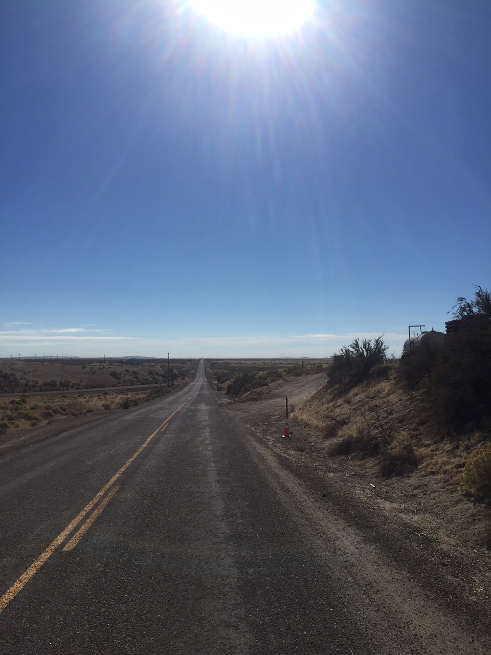
never-ending
From there it was back to the small roads, straight and seemingly without end. The desert flew by. There was no wind. I soon passed though Mountain Home, a military town, depressed and empty. The only things open were a Taco John’s, the payday loans place and a grocery store. A strange older fellow in a suit with a print tie of the words to the Lord’s Prayer asked if I worked at the Albertson’s we were standing in front of. He told me (some in Spanish, some English) that he’d moved here from Texas many years before and found the people of Mountain Home to be cold and unhelpful. “They’ll just leave you at the side of the road.” he said. He next asked me which I thought was wider, the Snake or the Rio Grande. “Lo siento,” I said, “yo no se.”
roads less travelled
Wide or not, I pushed on towards the valley of the Snake. The land was green again now, irrigated and full of corn, beets, hay and onions. Nobody seemed to be around. The few I saw looked as though they were heading toward church or away from it, or maybe to the church of televised football. The fact was that I’d been lazy this morning and not rolled out of Boise until nearly 9:30 am. If I wanted to reach Bliss before dusk I had to keep going. At Glenns Ferry (a place where wagon trains used to cross the Snake on their way west) the shadows started to lengthen. What’s more, my rear tube started to leak again. Last time it was a thin filament of metal that had done the damage — possibly a radial fiber from a destroyed roadside tire. I have yet to find out the source of the annoyance this time (I’ll get out the tire irons as soon as I’m done writing this) … but I’m in Bliss now, and fed too at a horrible gas station diner that I pray does not make me sick. The motel room is okay though, and it only cost $38. In the morning I resolve to get going early and make for Burley and points east.
Yesterday and today: tough, amazing, more good luck than bad. I’m in Boise, Idaho now … here’s what went down:
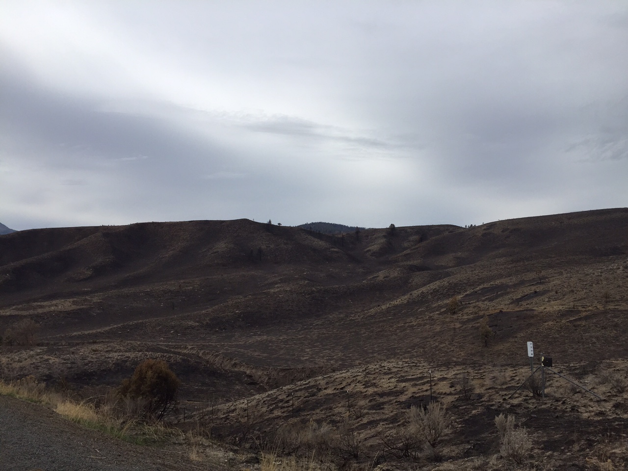
Yesterday morning I crawled out of Prairie City at the crack of dawn, and spent almost the whole morning in the Blue Mountains (two more 5200 foot passes, hell.) Then the country opened up — way up — around the little ranching outpost of Unity, Oregon into an expansive and harsh scrubland. I pushed on after only a brief stop at Unity’s only store (junk food, hunting supplies, strange lost boy in ripped up cowboy boots) and passed through the sloped rangeland which is at an altitude high enough that it must only be used in summer. This land was profoundly, completely deserted. El Dorado pass, another frustrating climb some 15 miles beyond Unity, had burned only a few months before and conformed well to my mental image of the slags of Mordor. Even the birds had abandoned it leaving only an eerie silence and the sound of the wind.
El Dorado pass.
All of this emptiness extended beyond the land and birds — I’d seen very few cars all morning. There were several half-hour stretches without anyone passing me in either direction. At about two in the afternoon (mountain time — I crossed the timezone line after the ghost town of Ironside) I descended to Brogan, a townlet at the head of a long valley that sloped some 35 miles down toward “civilization”. Brogan, if you were wondering, is the site of the Annual International Cow Pie Throwing Championship. The scatalogical obstacle course that was the shoulder of US 26 in this area made it clear why this is the case.
Ruins in Ironside, Oregon.
As the valley broadened, the air thickened and I pushed even harder to beat the oncoming rain. The roadside cow pies faded and were replaced by … onions. I’d entered a huge onion producing region, and for the rest of the day and part of the next the air would have a pleasant twinge of raw fresh onion, and the shoulders of the roads would become more of an onion slalom than anything else. Huge trucks loaded with recently harvested onions rumbled by me at low speeds, occasionally spilling a few after going over a bump. The rain finally came, but by then I was only 5 miles out of town, so I shut my brain on and pounded on to Vale, a little western town huddling beneath a huge rock.
That’s a lot of onions.
It was my biggest day of the trip — 101 miles, over 8 hours in the saddle, 5000+ feet of climbing, all in the middle of nowhere. In a way it was too much — not advisable — and I don’t think I’d plan such a day again. The reason I was able to get it done it was a) a reliable bicycle and b) mind games. Managing extreme amounts of exercise or exertion turns out to be all about desire, and the manipulation of desire. When uncomfortable, I long for the removal of the source of discomfort. When in a high desert under a threatening sky, I long for even the smallest ex-town. This longing is the basis for motivation, for climbing one more hill, for making it to the next named place. I manipulate hunger and thirst too — “you can have a gatorade at the top of the pass” — “you can eat a cliff bar in Ironside.”
The worthies of Vale, Oregon watching Thursday night football.
I finally rolled into Vale, Oregon and quickly found a place to stay. It was a vast downstairs story of a basic main street hotel, a place usually reserved for large parties of hunters (there were six beds and a kennel room for bird dogs.) But the hotel manager gave me a good deal and there was a busy Mexican restaurant across the street. I entered, ordered a beer and a very large burrito. Some of the other diners wore huge cowboy hats, or caps bearing the emblems of seed companies. The local lions club showed up in their yellow vests — a troop of hooting senior citizens. Their headquarters seemed to be attached to the back of this Mexican place and after many greetings and a few dirty jokes to their friends at the bar they disappeared into their sanctum for a meeting. Families and ranch couples packed the dining room. The place had a buzz of human warmth about it. I’ll always think of Vale as the sort of place where people huddle together against the vastness of what’s outside.
***
I slept in this morning, rolling out of Vale at about 10:30 after a lazy breakfast of oatmeal and eggs. To the east the land changed yet again, and so did the atmospheric conditions: there was a wind — a significant one of 15-20 mph, and it was on my side. All day it blew me onward, sometimes shifting to my flank for a while if the road wound around, but it was pretty much a perfect tailwind. It also gave me a new respect for the wind as a force. Had it instead been a headwind (from the southeast rather than northwest) it would have turned today into a hellish slog. But as it was, it made today’s 70 mile ride — dare I say it — easy?
desert valley outside Vale
Around noon, I crossed the Snake River in Nyssa, Oregon and entered a new state: Idaho! I’ll be in Idaho until a week from today, and on or near the Snake for much of that. I’ll be tracing (in reverse) the main route of the Oregon trail through places like Glenns Ferry, Twin Falls and American Falls. The early settlers were constantly vexed by this river, which plunges in and out of various gorges, over falls and fans out to define islands and various points. It’s a strange, wily kind of waterway — one of the most easterly to support a historical pacific salmon run. But for today, I got just a glimpse before returning to onion-dodging on the eastern bank.
Snake River
The rest of the day was a bit blah. I crossed I84 (my first glimpse of an interstate since suburban Portland) and then slowly slid into the suburbs of Boise. Traffic! Strip malls! Stop lights! These sorts of annoyances hadn’t been part of my life for almost a week, and they seemed particularly jarring. The last 10 miles of today I spent on a lovely (if occasionally unpaved) trail which traced the Boise river right into downtown Boise. My rear tube had finally had enough, despite my bullet-proof rear tire, and I developed a slow leak that I had to top up a few times, but no matter — I was almost home, the path was lovely, and I could see hipsters (hipsters!) as I rolled into central Boise.
It’s been an amazing week — about 460 miles of astounding country. Tomorrow I rest.
Today was a short day — only about 40 miles. But it still left me bone-tired. I’ve tried to come up with a good description for what I felt in my body at day’s end, but it’s a difficult kind of exhaustion to explain. I need to dig deep and find my reserves, my other gear, because today was largely about setting up tomorrow — a significant day on this trip for a number of reasons. First, there’s a decent amount of climbing — I’ll be crossing another mountain range in the morning (my third) before descending all the way into the valley of the Snake River. Second, the weather (heretofore perfect) has become less predictable, and there may be showers tomorrow afternoon. Since I’ll be over 5,000 feet for part of tomorrow morning (I’m starting at 3200 feet today) I want to get the high, cold part of tomorrow done before there’s any threat of rain. It should be doable — if I leave early enough I’ll be back down to my present altitude before the potential rains are even close, but it is something worth planning around. Finally, there’s the matter of me not being quite sure where I’m going to stay tomorrow night in the dinky town of Vale, Oregon. I called the only motel in town with a reliable phone and was told they’re full. I’m going to try again, but I’m not too hopeful and I may have to look downmarket, which is a bit of a scary thought since the one with a phone is — no kidding — called the Bates Motel.
Deer in shadow of abandoned schoolhouse. Between Dayville and John Day, OR.
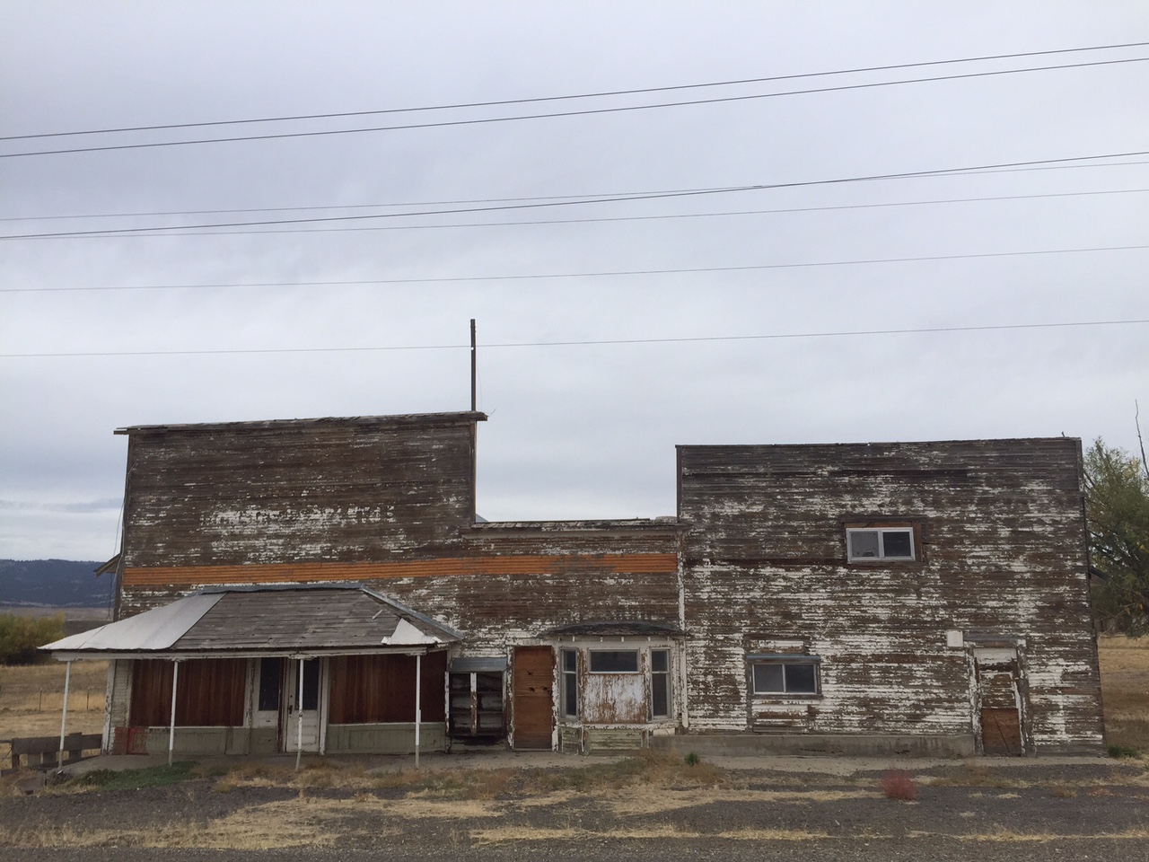
Now that I think about it, this country, though beautiful, has its spooky side. There were lots of scenes today like the above. Things that used to be things, and are now ex-things. Here’s another one: the recently-shuttered mill at Prairie City:
Ominous sky over closed sawmill.
But I’m safe and happy anyway — and all because of the overwhelming welcome I received here in Prairie City, Oregon. Jimi, my host from yesterday, has really pulled out all the stops. He’s a retired Forrest Service employee who still does some contracting for the government. He’s also a cyclist, and a member of warmshowers, a kind of couch-surfing app for cycle tourists. His house sits right off the Trans America route, which is one of several recognized and heavily trafficked cycle routes across the continent. He and his family have hosted visitors from all parts of the country and world — even someone from the Canary Islands, he tells me. As his son Daniel prepared dinner, Jimi gave me a futon to sleep on and a beer and generally made me feel like I was a welcome guest. Later, detecting that I was being cagy about my “family situation” (this is after all about as red a region as you can get — I saw a huge “Impeach Obama” sign on a barn-side on my ride today and many a fundamentalist church) Jimi was gracious enough to out himself first — not as LGBT or anything but as a “liberal.” It was an act of pure hospitality, and one that allowed me to completely relax into being myself in this house with these fine people. I was the “first gay guy they’d had” … and I imagine that if they’d been tracking visitors on a map of the world with pushpins, I’d have received my own special pink one — in the best possibly way. It was Jimi’s anniversary, but he’d been called into work this week and couldn’t go backpacking with his wife, who was away in the wilderness somewhere. Instead, he drank most of a bottle of wine as we sat out on his porch with Daniel (a smoke jumper.) The sun slowly sank down behind the blue mountains. Haze drifted up from the remnants of this year’s fires above John Day. Tomorrow’s going to be just fine.